MountainMath Software and Analytics
MountainMath Software is Vancouver, BC based company specializing in data, analytics, modeling and visualization.
HCB
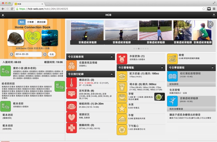
Simplifying Daycare Operations, Connecting Parents.
CensusMapper
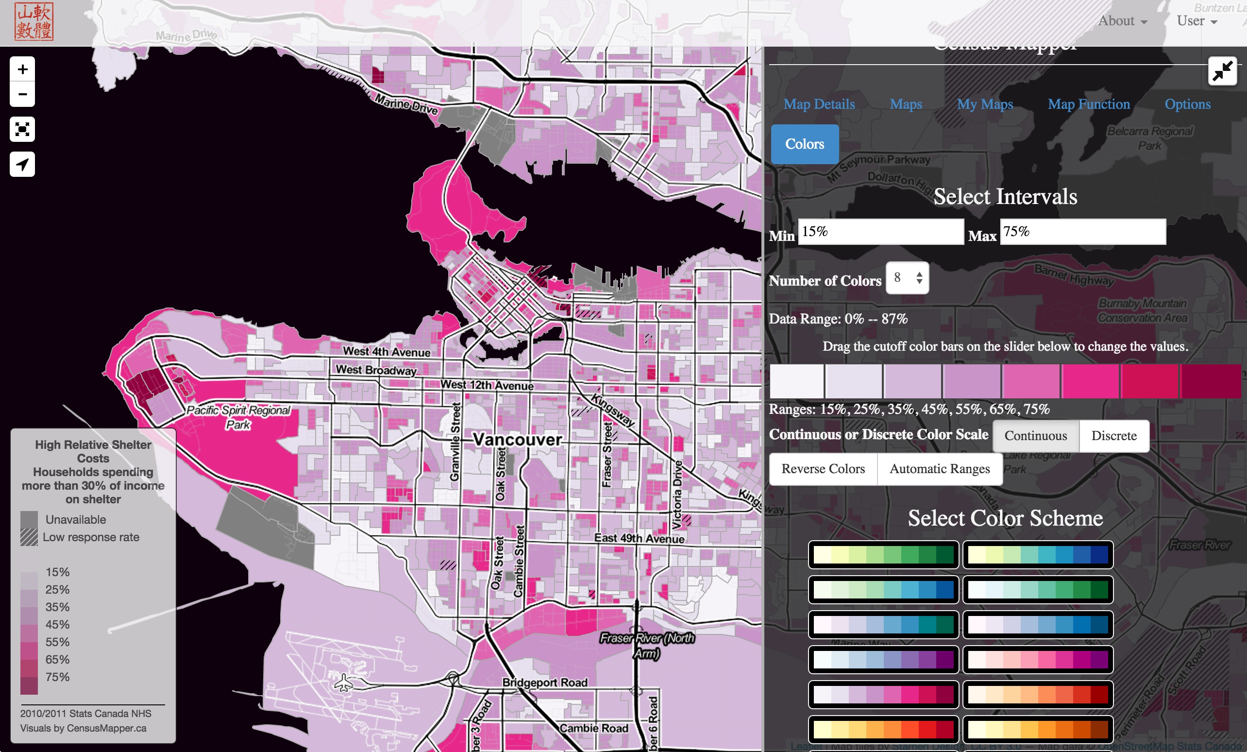
Putting the "open" into StatCan Census open data, making it accessible to everyone.
Teardown Index
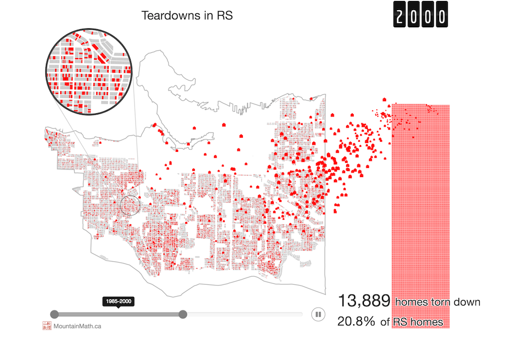
Data story looking at Vancouver's teardown cycle.
BikeWalkUBC
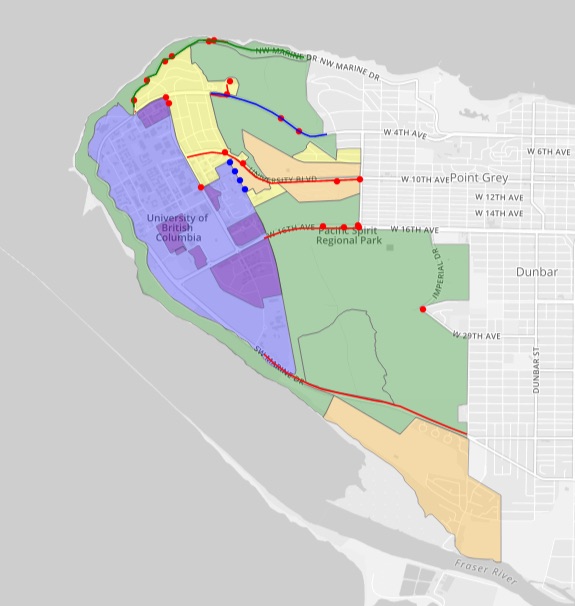
Community engagement and collaborative mapping tool to address walking and cycling issues around UBC.
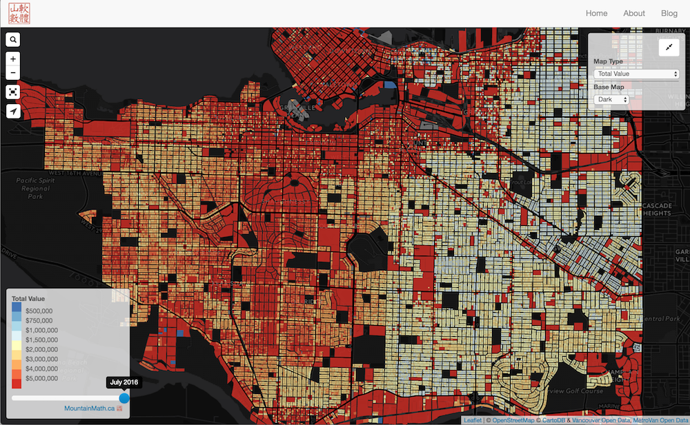
Vancouver Assessment Map
Visualizing Vancouver assessments and related data.
Vancouver Tax Density
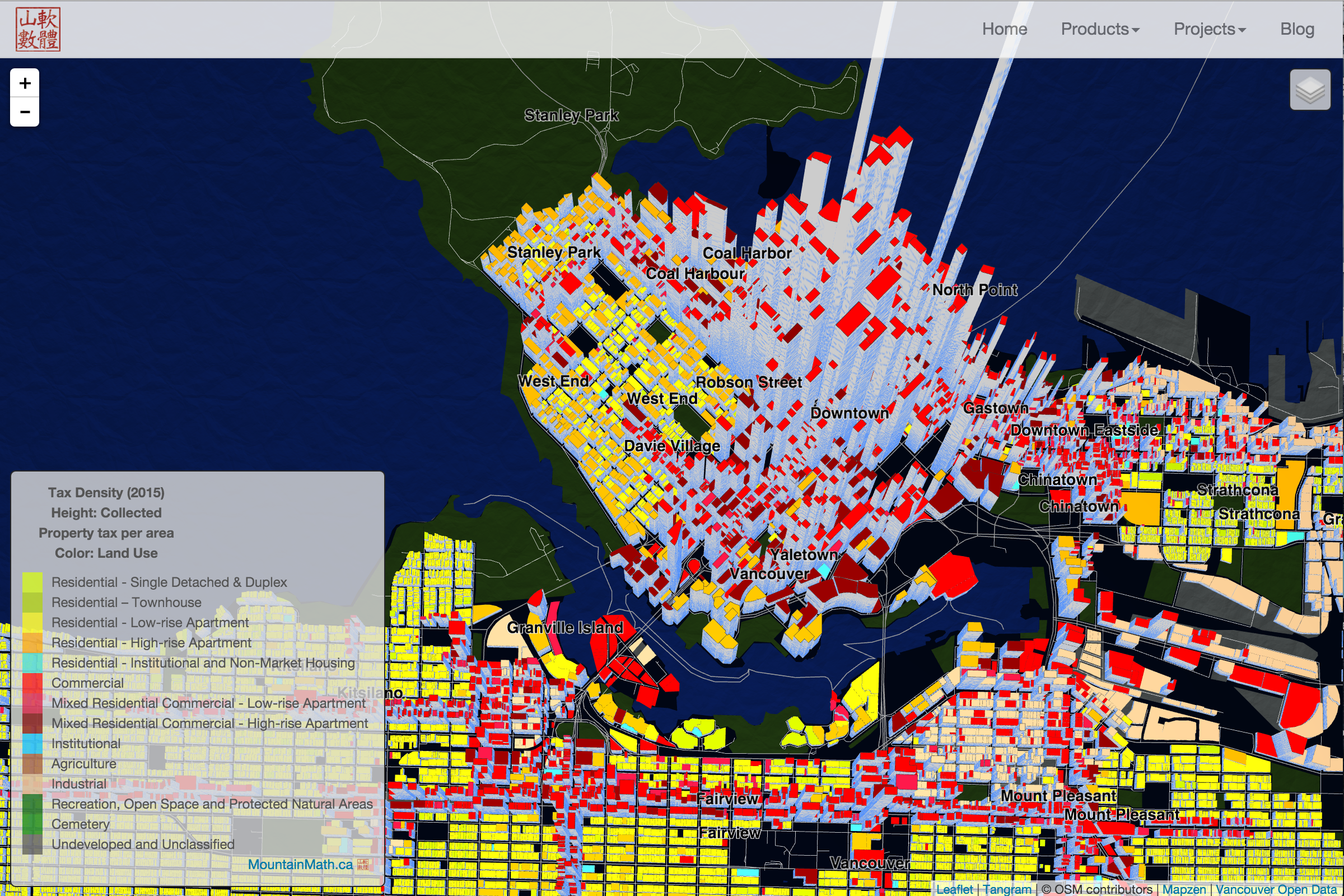
Visualizing Vancouver Property Taxes collected per area by land use or zoning.
Vancouver Land vs Buildings
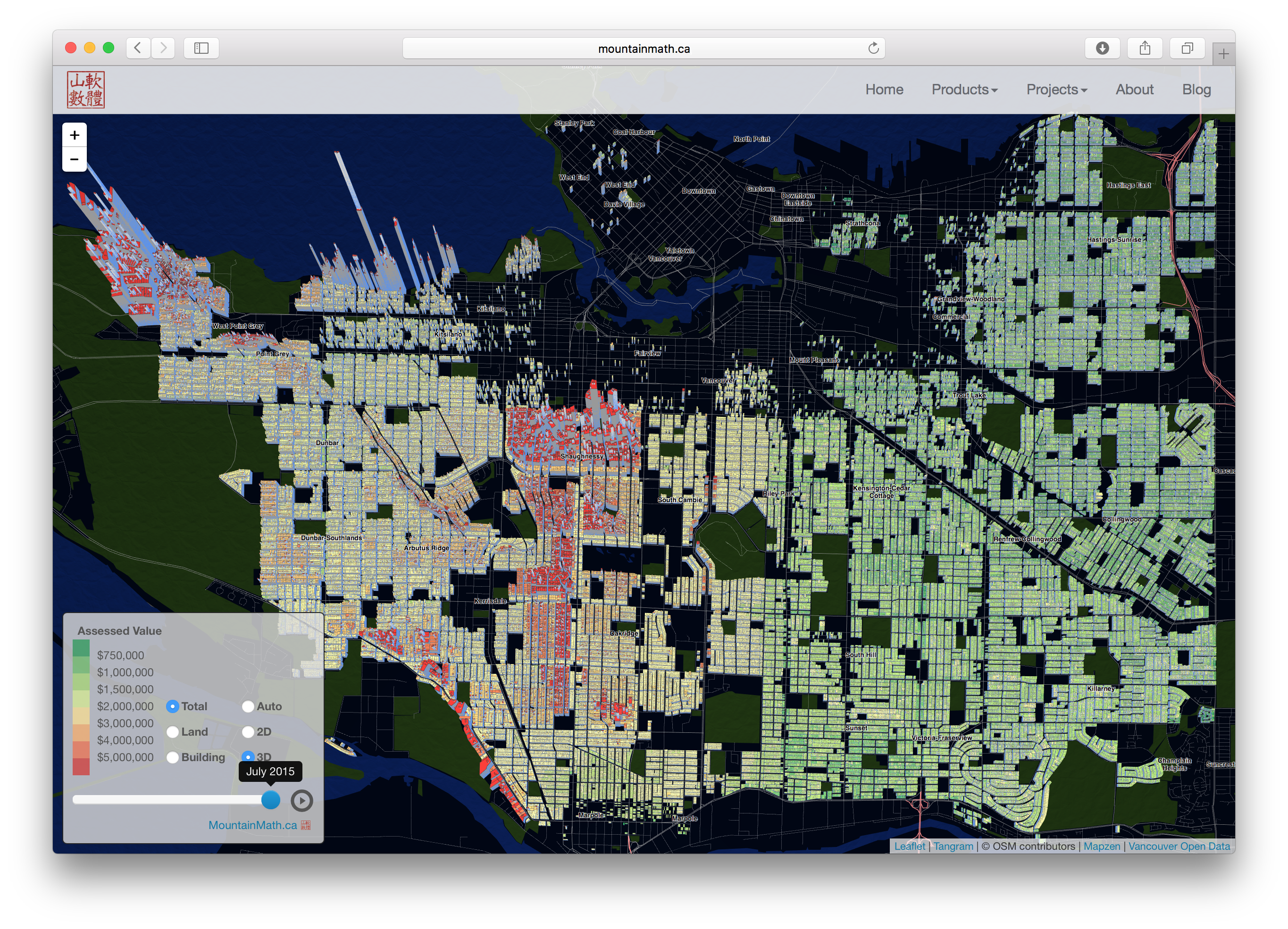
Animating Vancouver's residential land and building values over time.
Vancouver Census Exploration
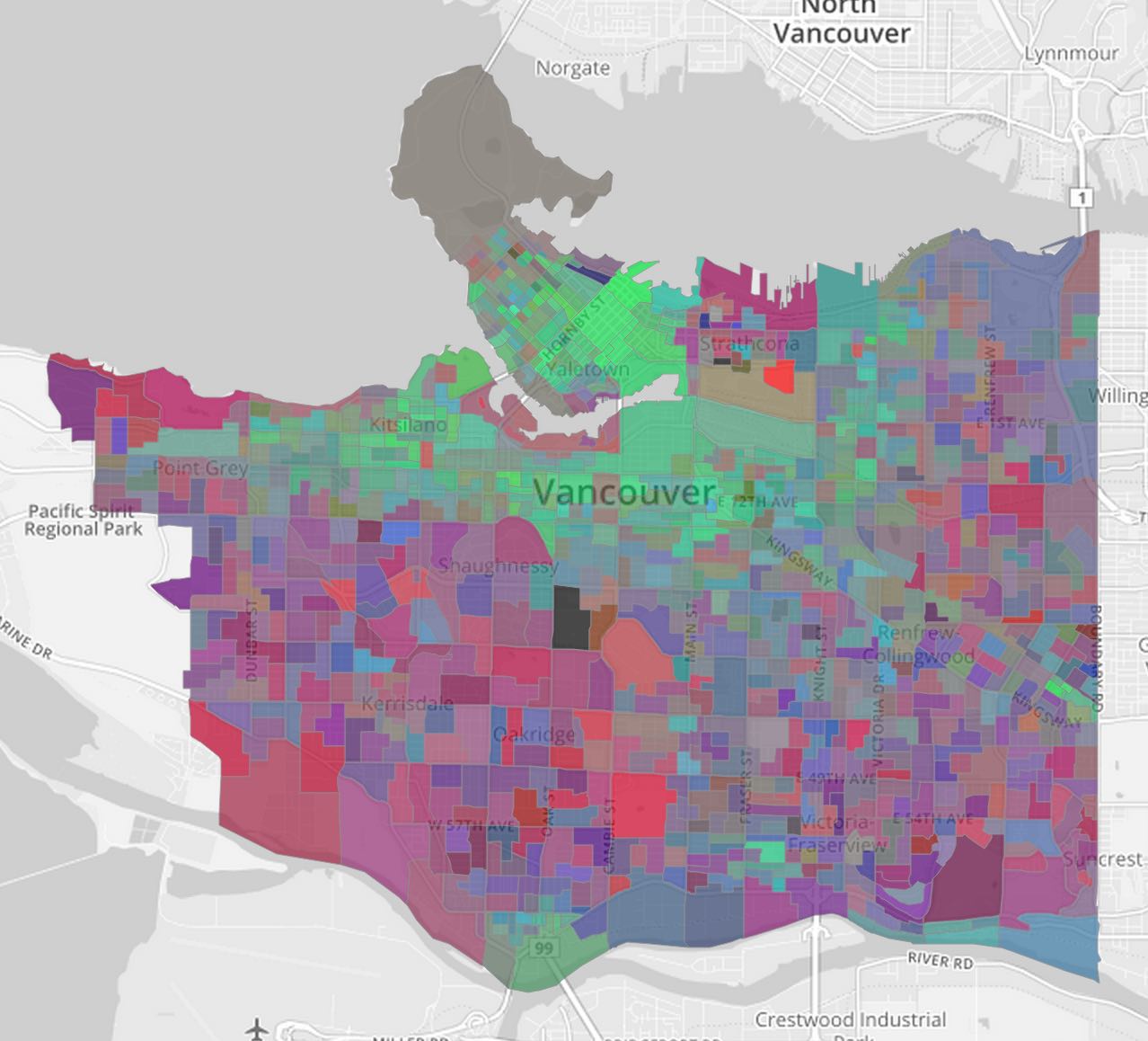
Mapping Select Census Variables for City of Vancouver.
Vancouver Building Heights
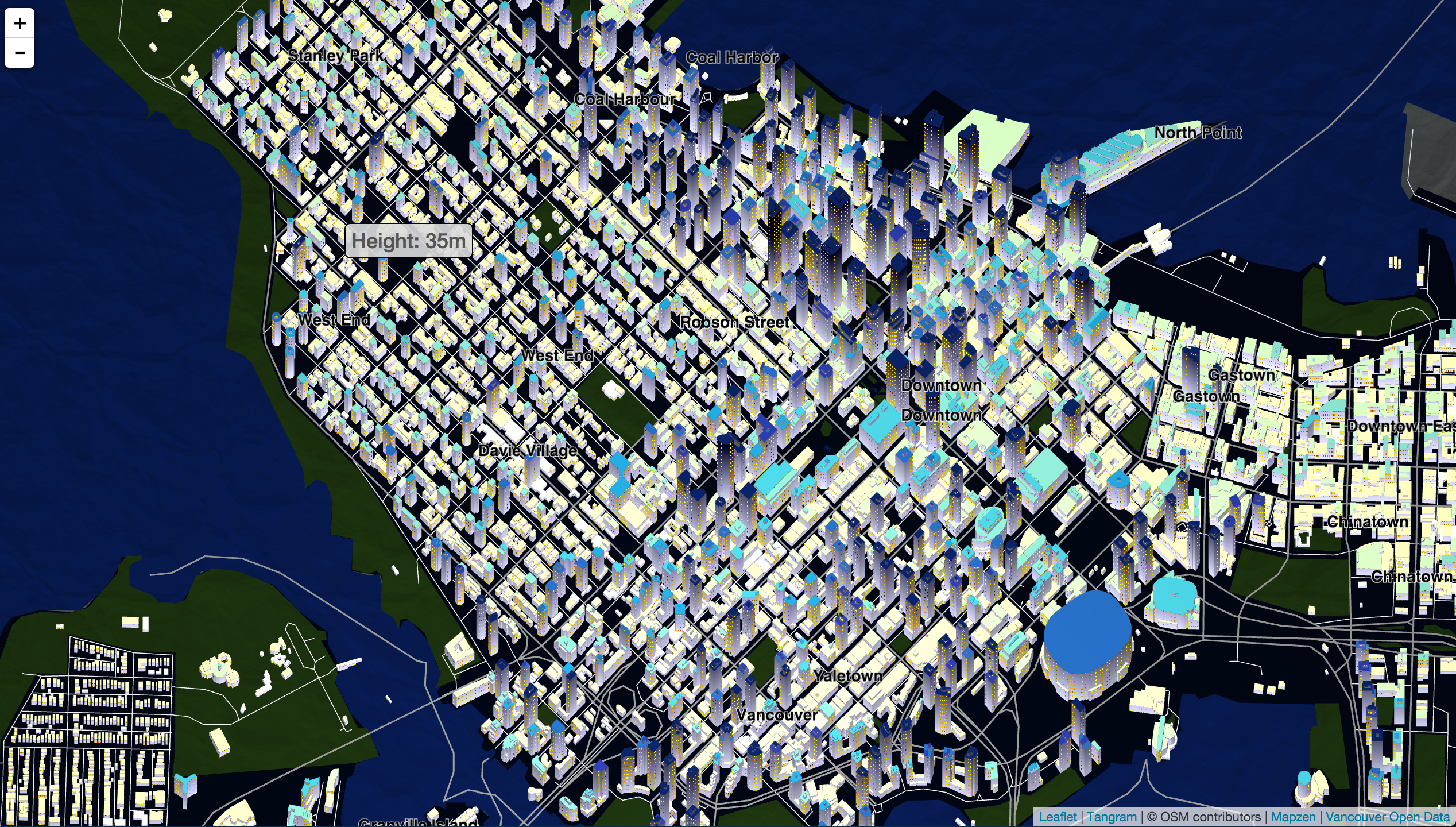
Mapping LIDAR-generated Vancouver building data in 3D.
Mixing Census & Property Data
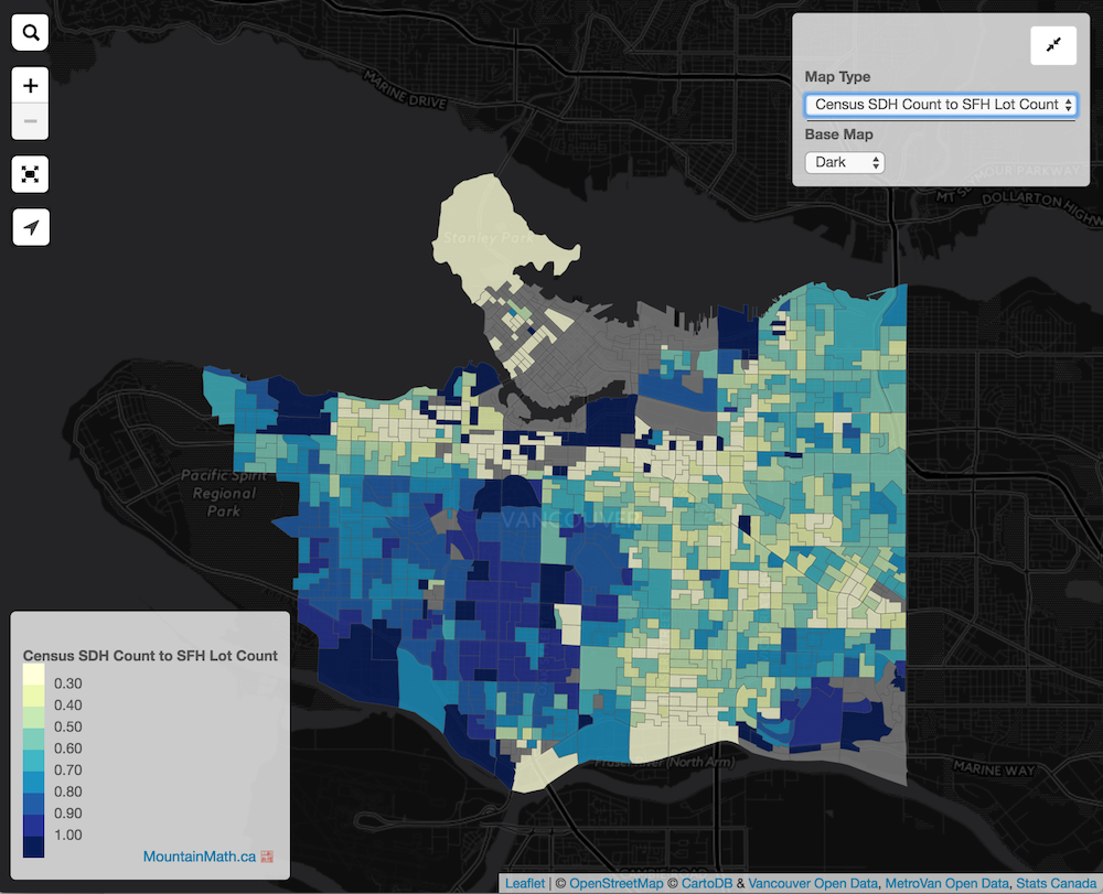
Mixing Assessment with Census data.
Surrey Traffic Loops
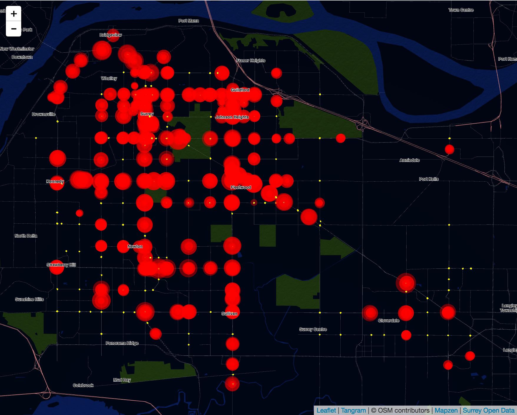
City of Surrey traffic loop counts from 24 hours ago.
Mobi Bikeshare Map
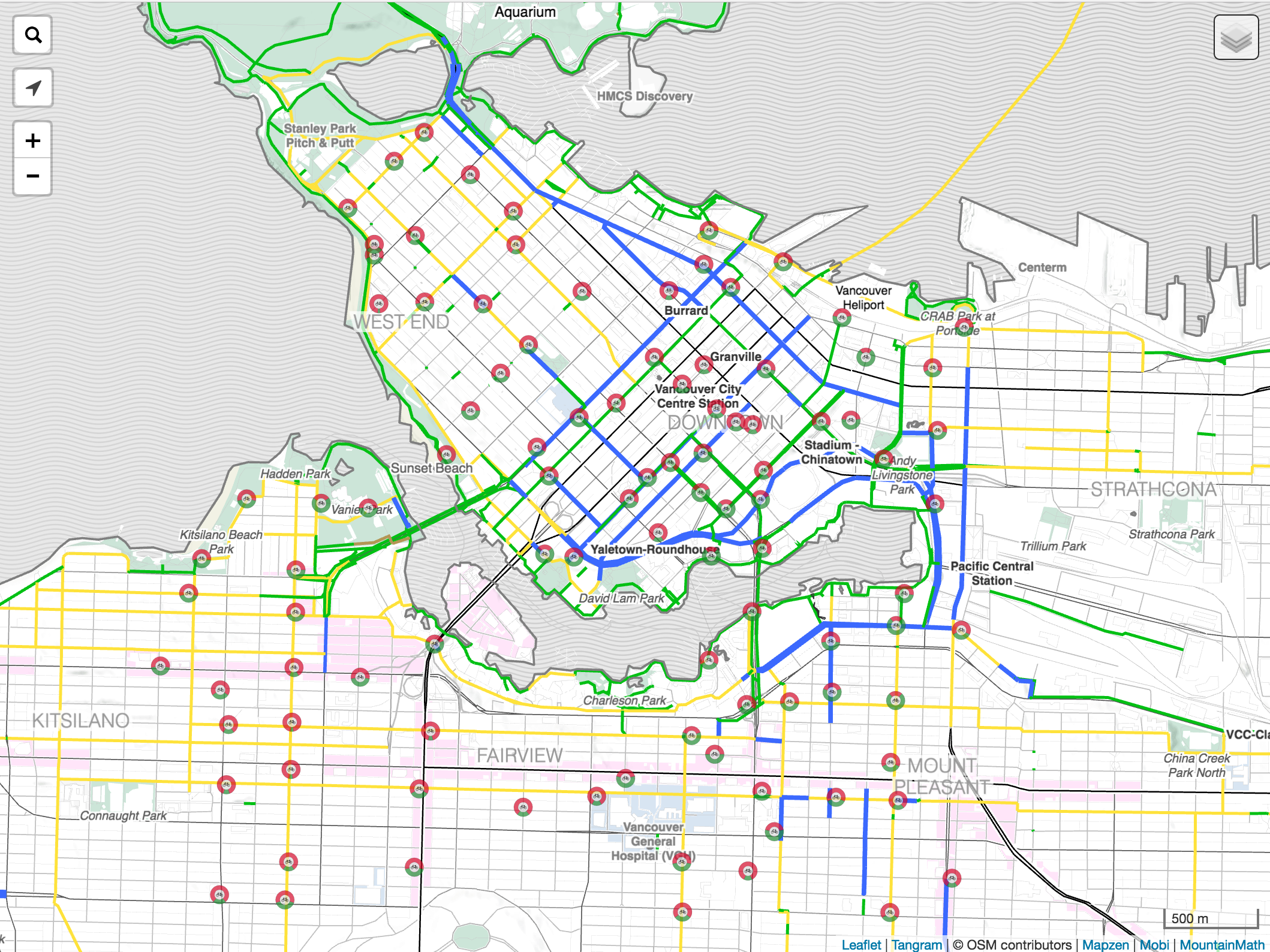
Custom map designed for cycling with Mobi bike share stations.
Global Bikeshare Map
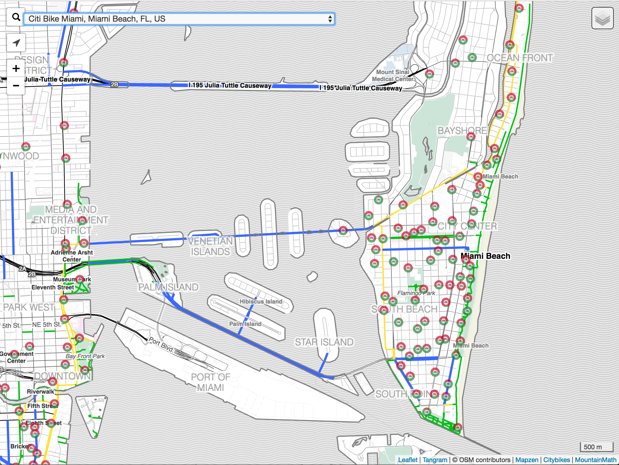
Custom map designed for cycling with dropdown to select global bike share cities.
Household Density 3D
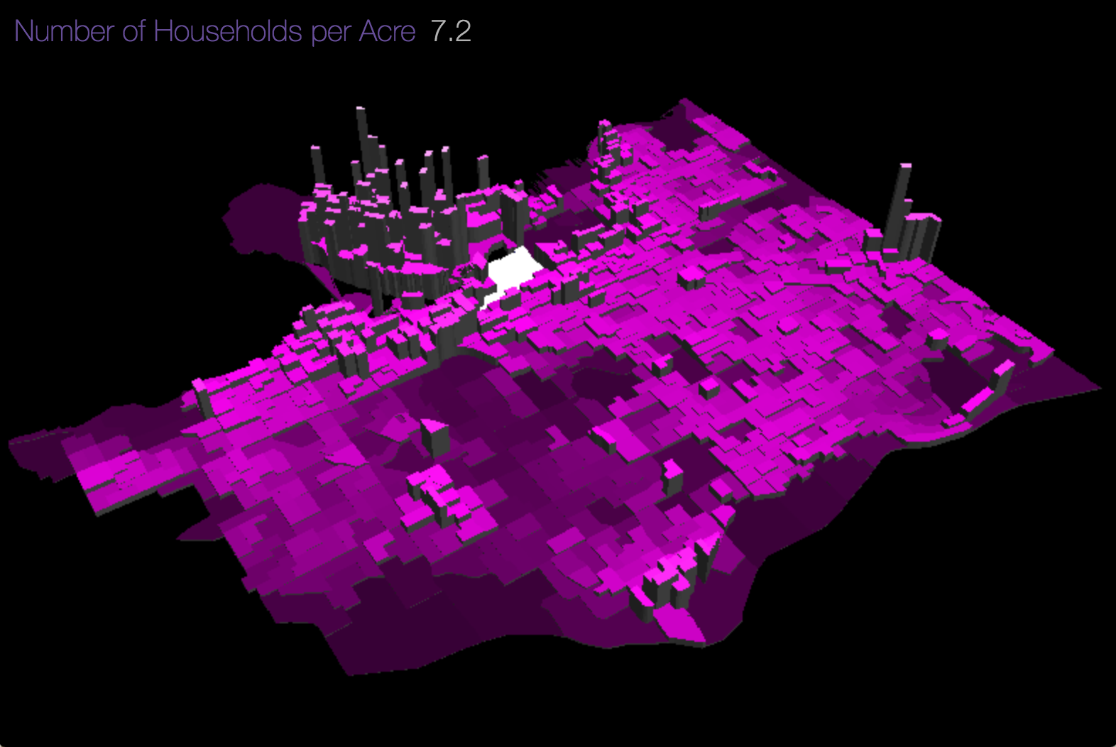
Exploration in 3D Census data visualization.
Elevation 3D
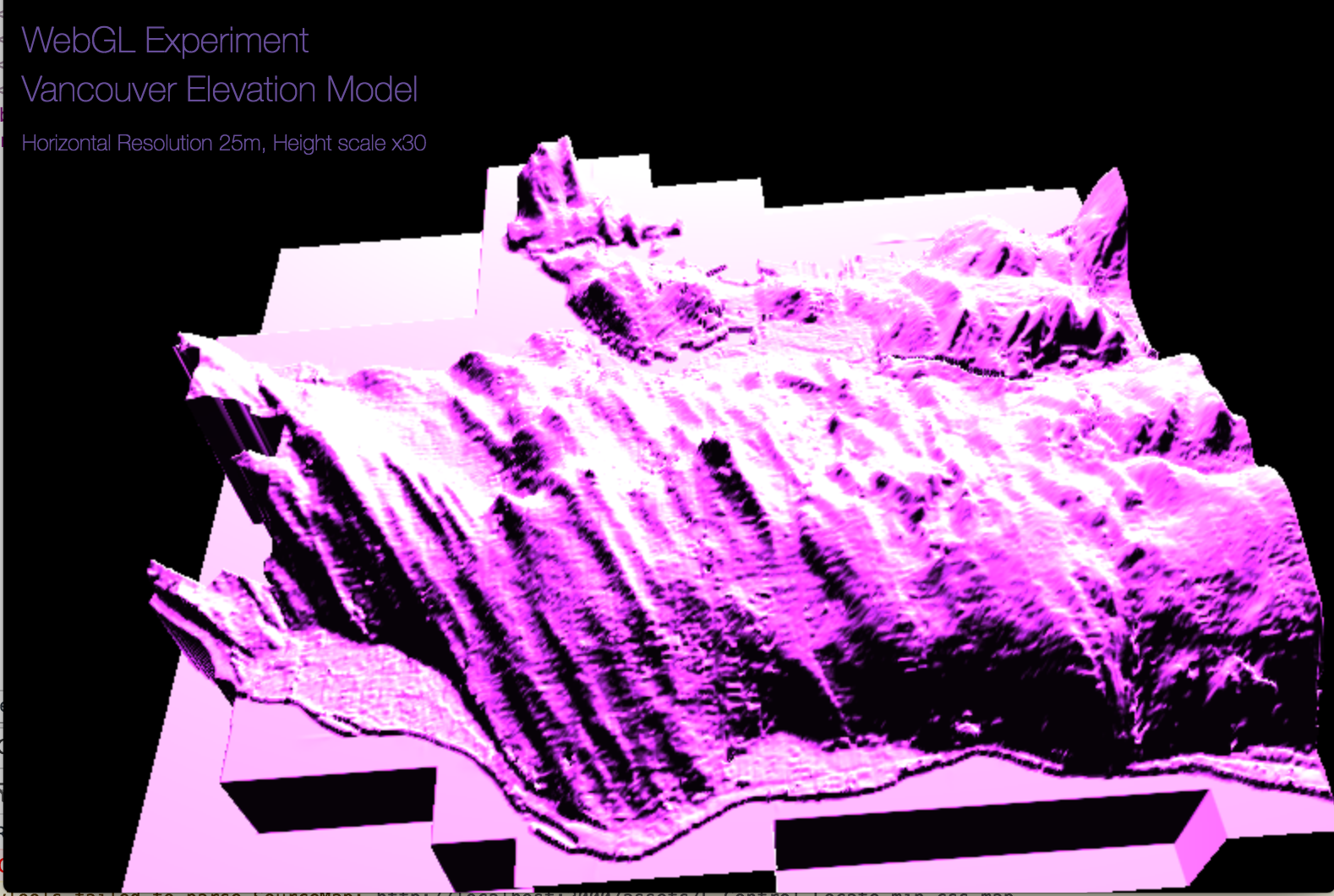
Exploration in 3D elevation data visualization.
Vancouver Home Values
Mapping Vancouver property values and value changes over time.
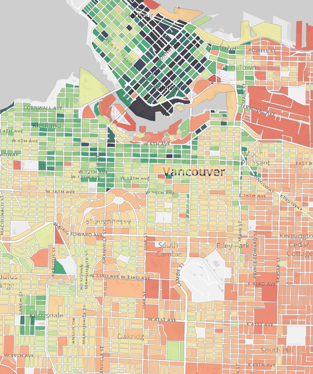
Metro Vancouver Land Use
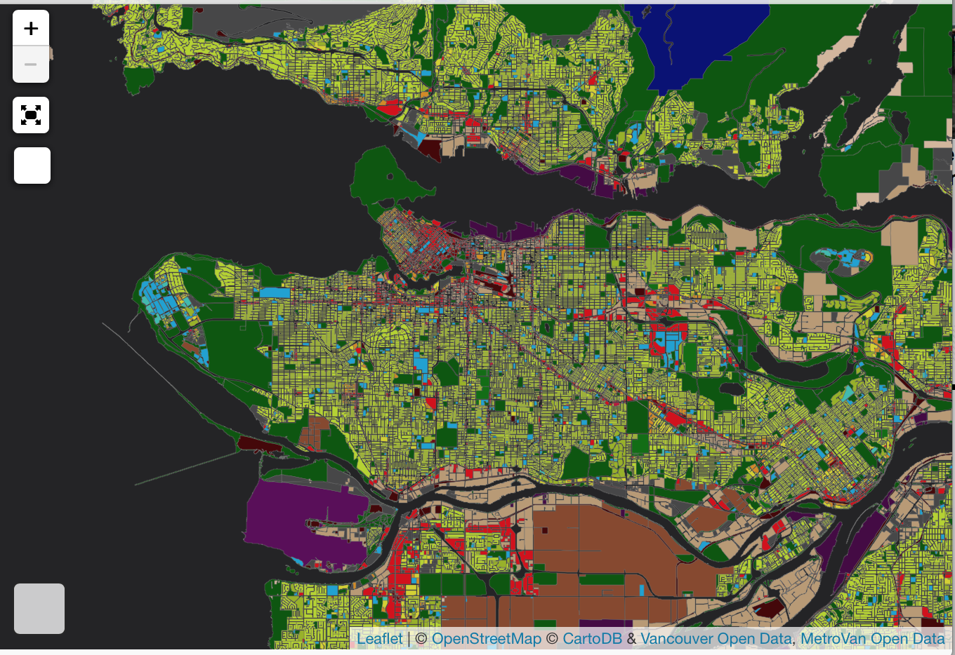
Interactive high-detail land use map.
Global Seal Level Rise
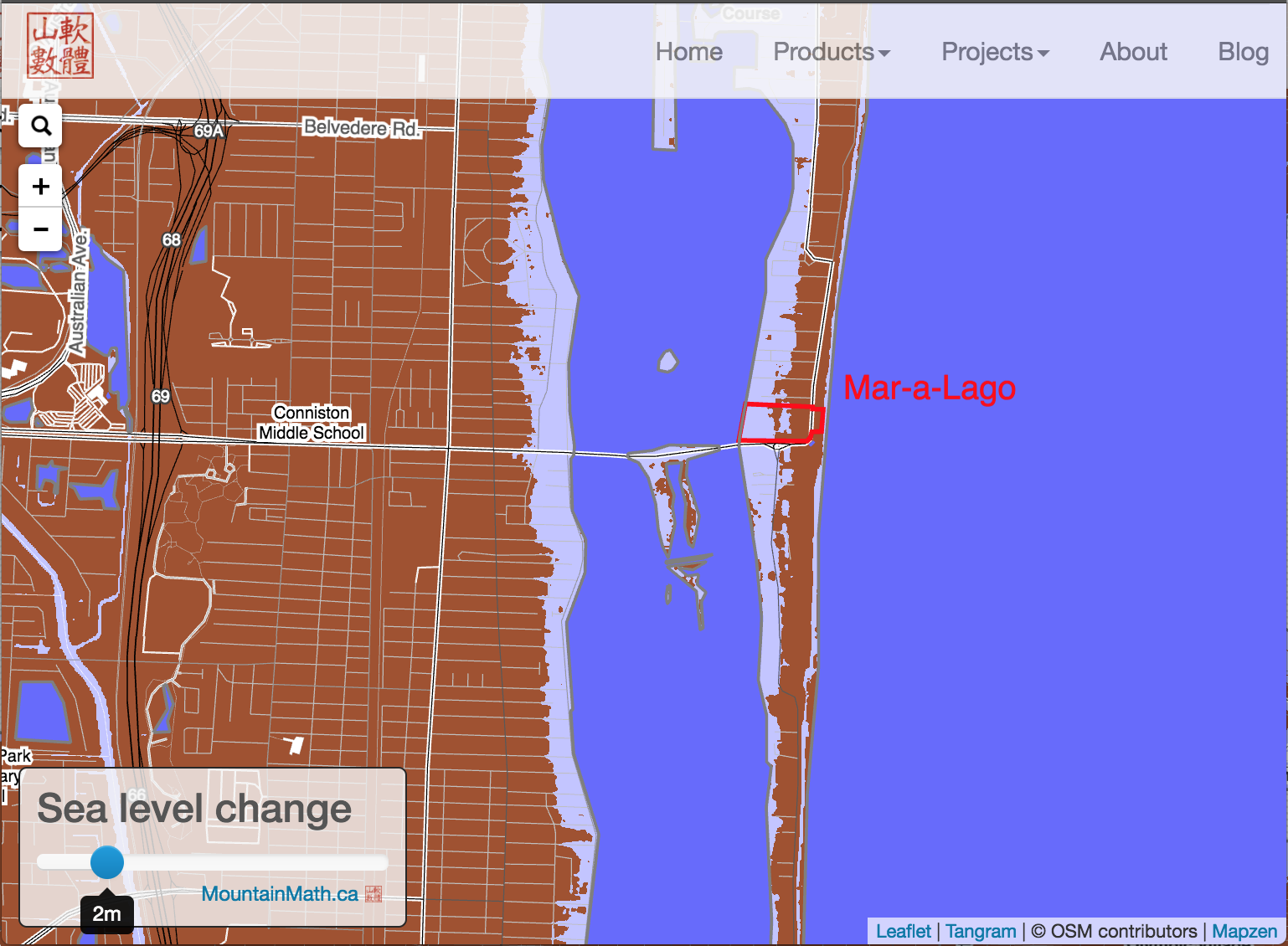
Interactive global seal level rise map.
Transit Coverage
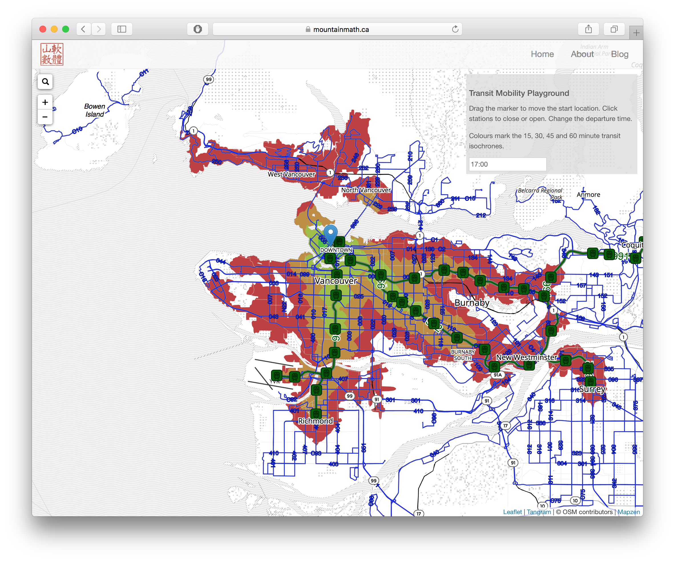
Interactive transit coverage explorere.
Vancouver Street Trees
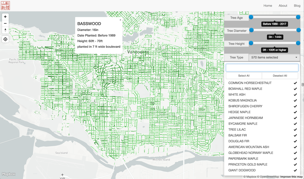
Interactive exploration of Vancouver street trees.