canpumf
R package for ingesting and working with Statistics Canada Public Use Microdata Files (PUMF).
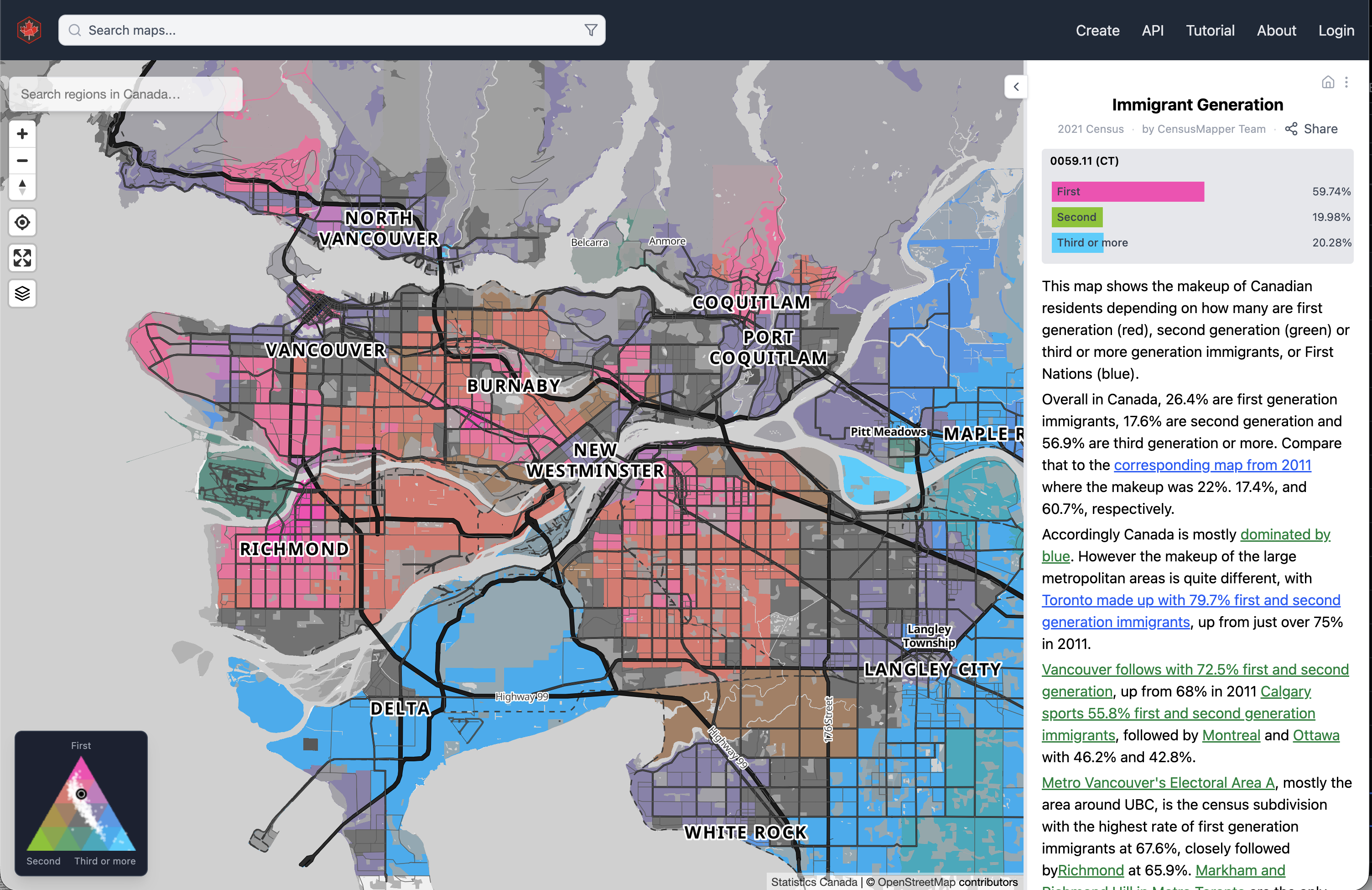
CensusMapper
Putting the "open" into StatCan Census open data — making it accessible to everyone.
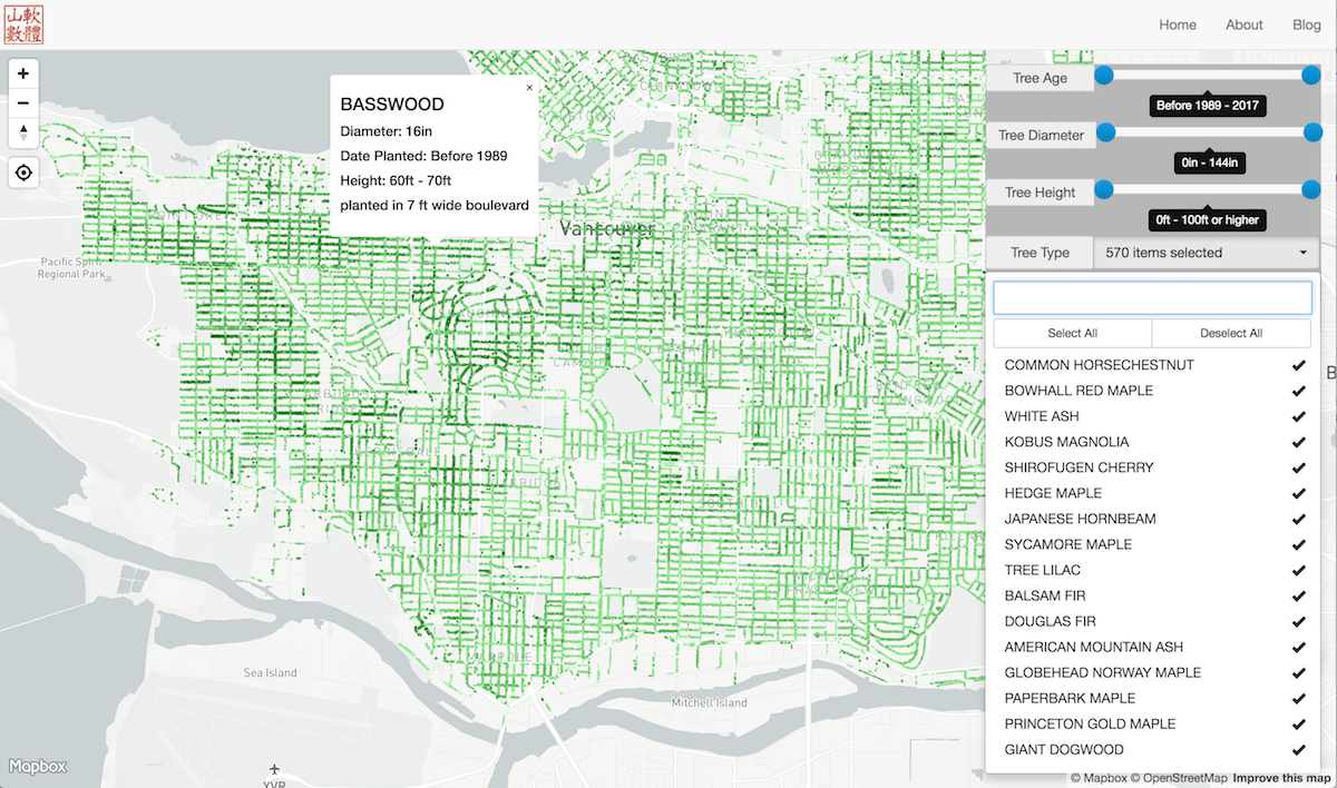
Vancouver Street Trees
Interactive exploration of Vancouver's entire street tree inventory.
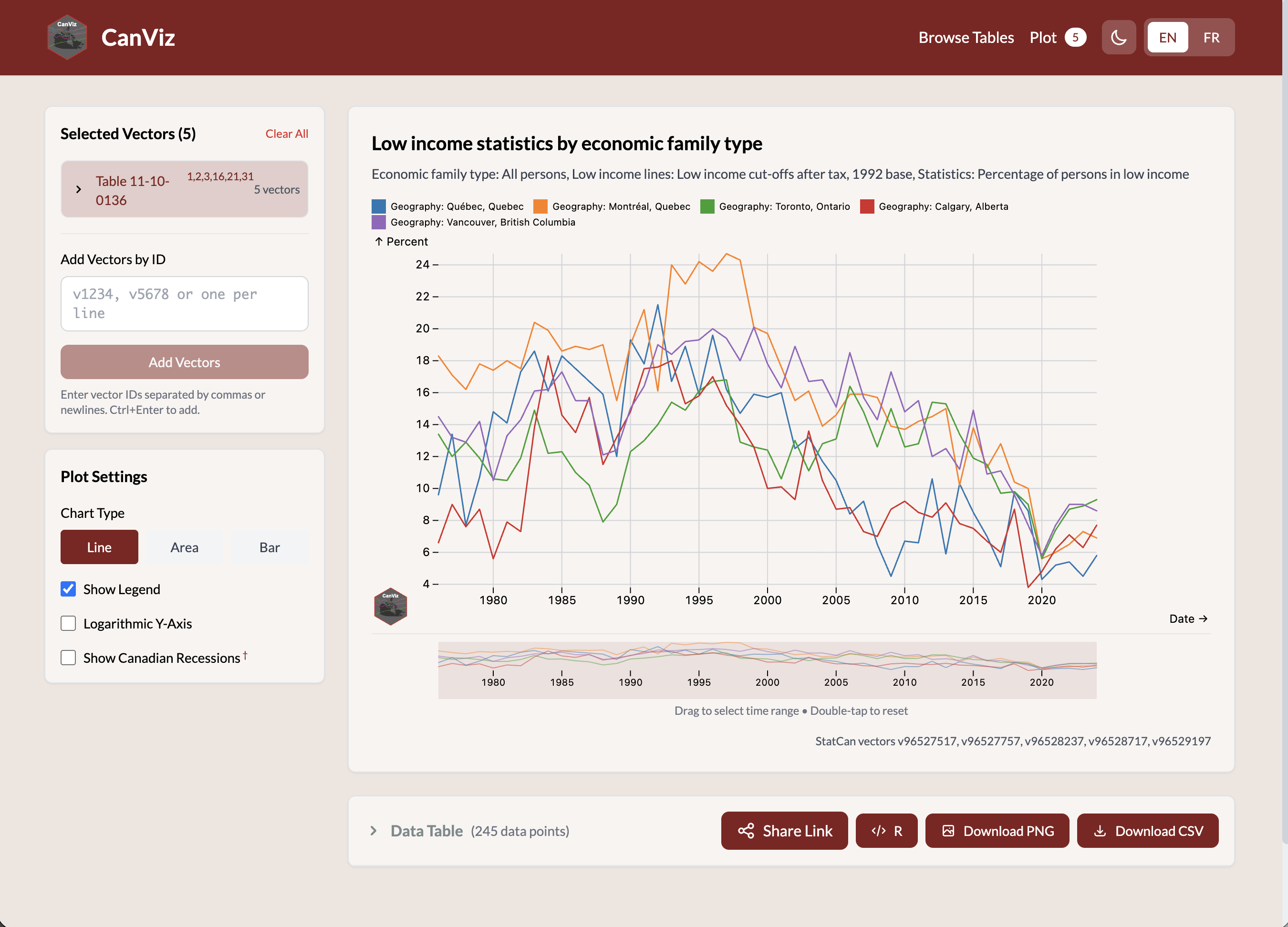
CanViz
Interactive visualization of Canadian census data across geographies and time.
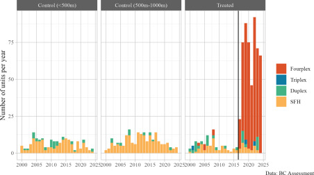
Upzoning and Redevelopment: The Details Matter
Comparing two similar BC multiplex upzonings to show how implementation details — permitting timelines, design pre-approval, parking rules — drive dramatically different redevelopment outcomes.
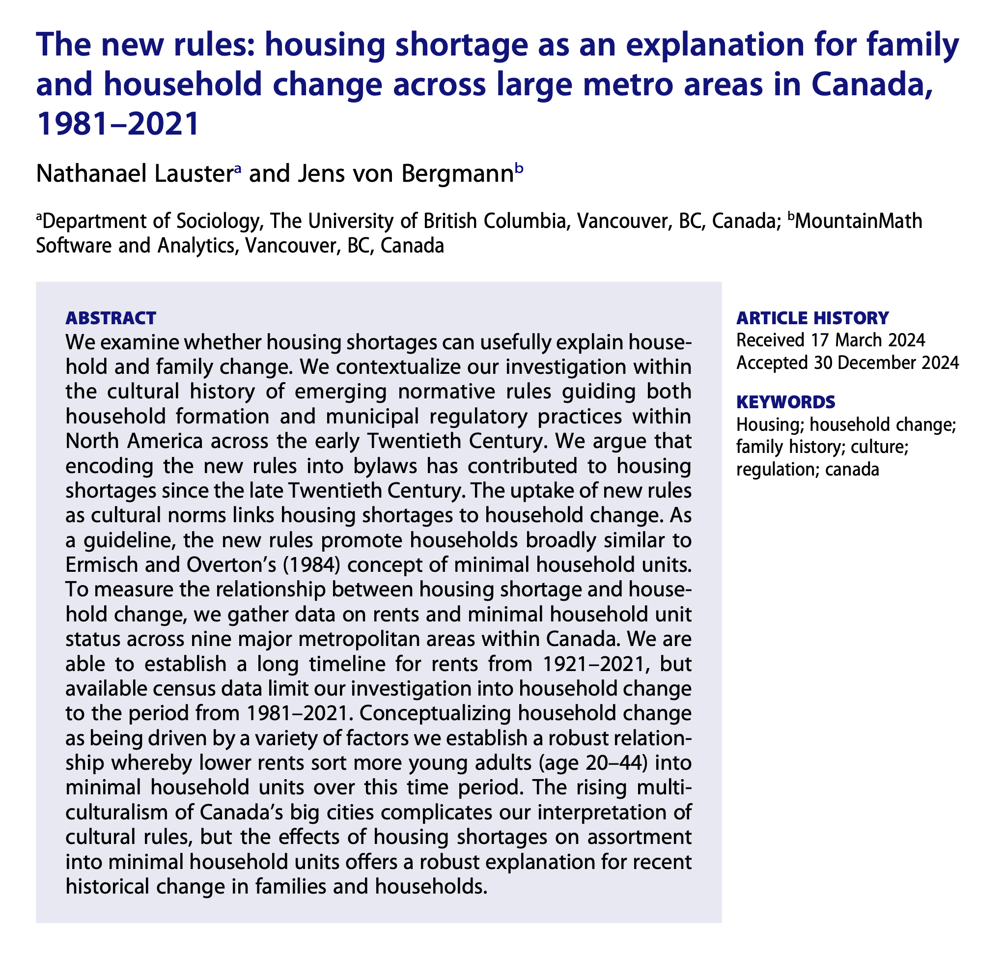
Housing Shortage & Household Change
Estimating the impact of housing shortage on family and household structures across large Canadian metro areas, 1981–2021.

Housing Shortages & Doubled Up Households
Tracking doubled-up households to better understand housing shortages and benchmark how much more housing is needed to fix them.
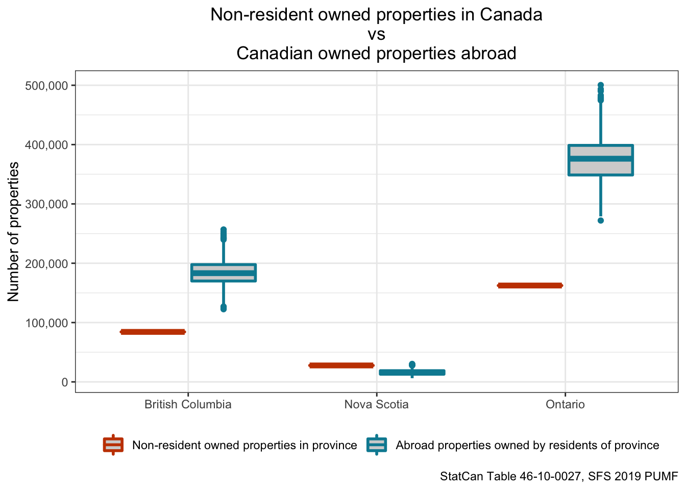
The Rise of Housing Nationalism in Canada
Examining transnational property ownership patterns in Canada and the political discourse around foreign ownership.
BC Housing Policy Modelling
Modelling the impact of BC's small-scale and transit-oriented housing legislation on housing supply.
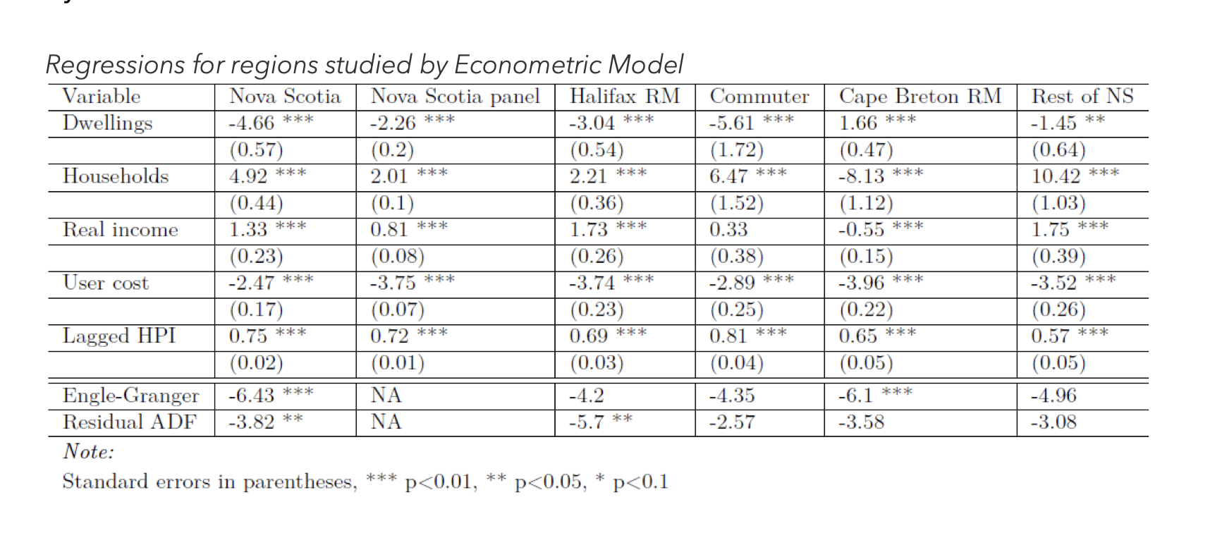
Nova Scotia Provincial Housing Needs Assessment
Econometric modelling of Nova Scotia's provincial housing needs, informing the government's housing supply targets and policy framework.
Analyzing Canadian Demographic and Housing Data
Building skills and community to analyze Canadian demographic and housing data.
canbank
R package for accessing Bank of Canada data.
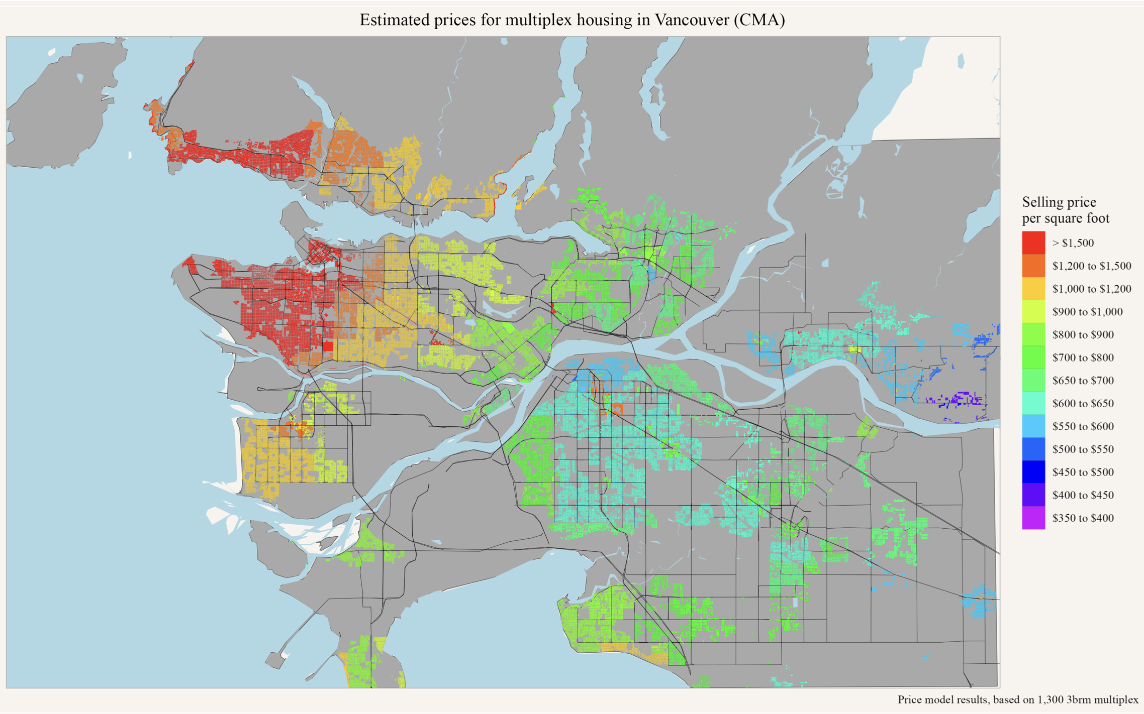
Metro Vancouver Zoning
Mapping zoning by-laws from 21 Metro Vancouver municipalities to examine how regulations shape housing supply, dwelling density, and development potential at the lot level.
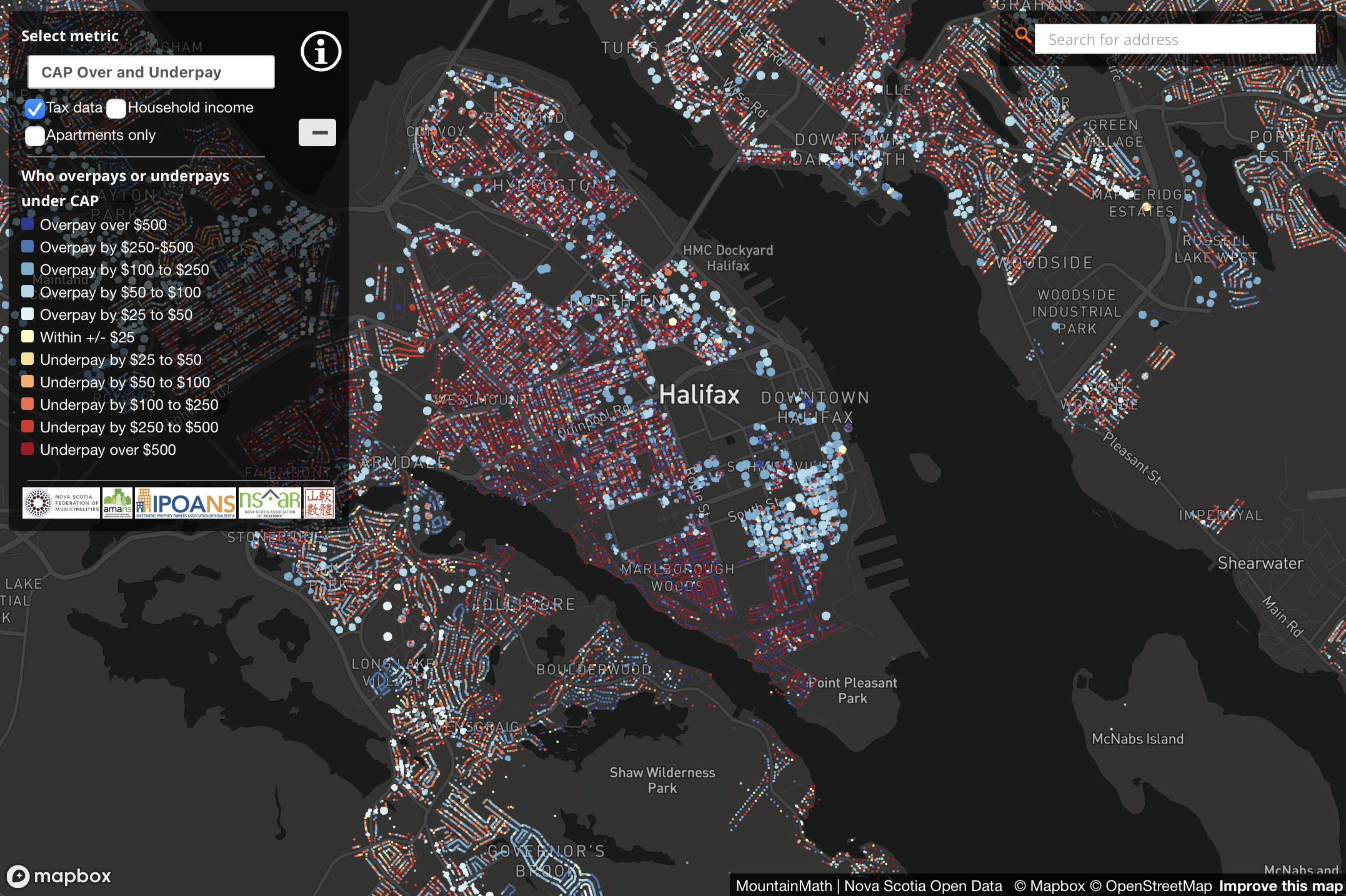
Nova Scotia Property Tax Cap
Analysing the impacts of Nova Scotia's property tax cap on assessment fairness and municipal revenues.
VancouvR
R package for accessing City of Vancouver open data.
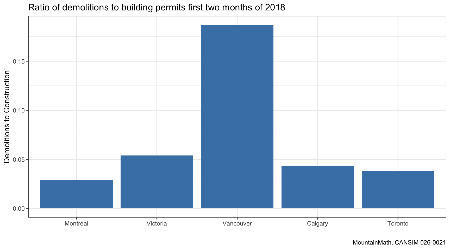
Teardown Index & Carbon Emissions
Quantifying the impact of Vancouver property values on CO₂ emissions from teardown and rebuild cycles in single-family housing.
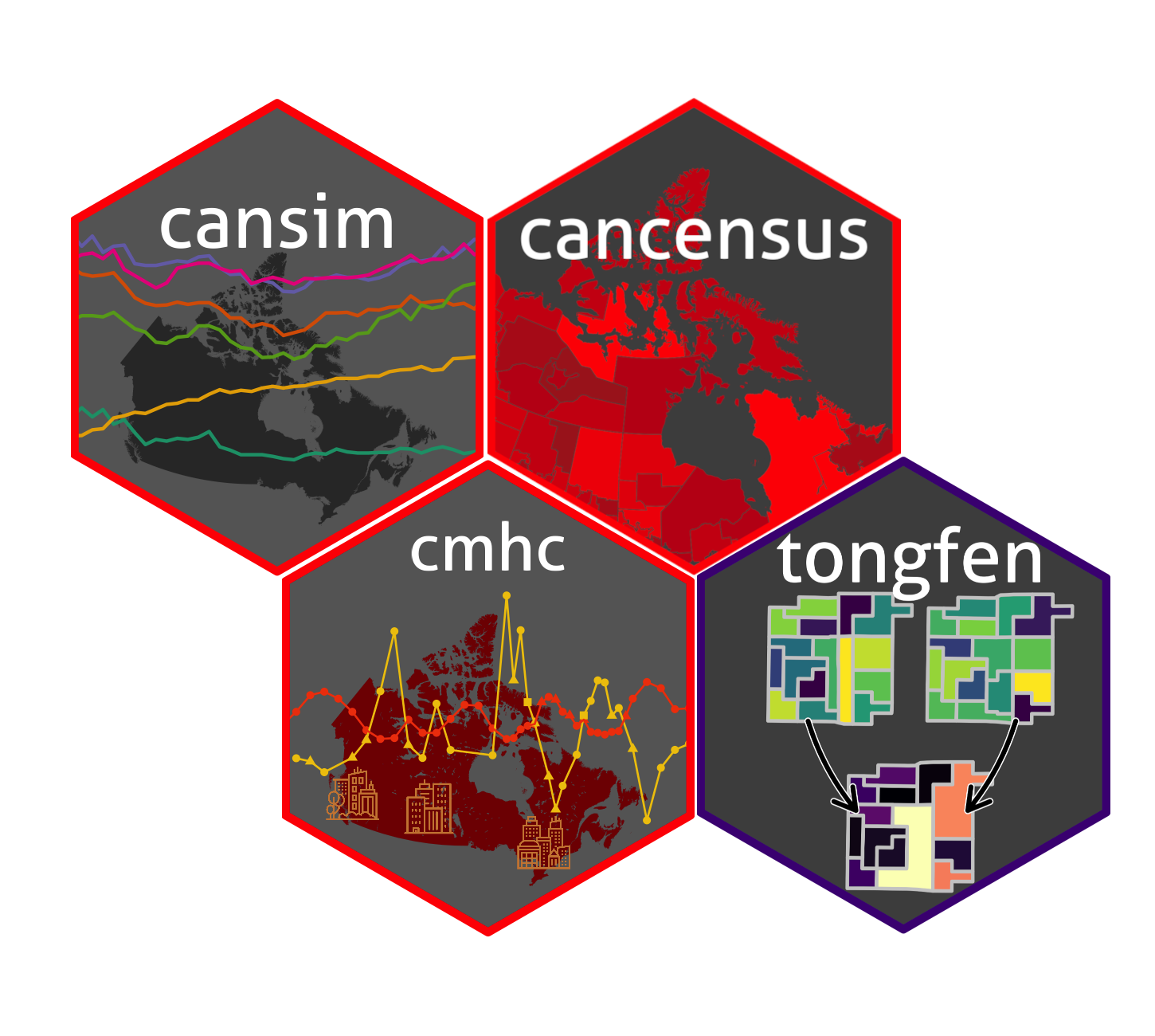
tongfen
R package for making data on different census geographies comparable across time.
cansim
R package for accessing Statistics Canada CANSIM/NDM data tables.
cmhc
R package for accessing CMHC housing market data.
cancensus
R package for accessing and working with Canadian census data via the CensusMapper API.
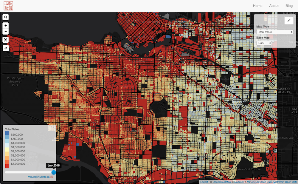
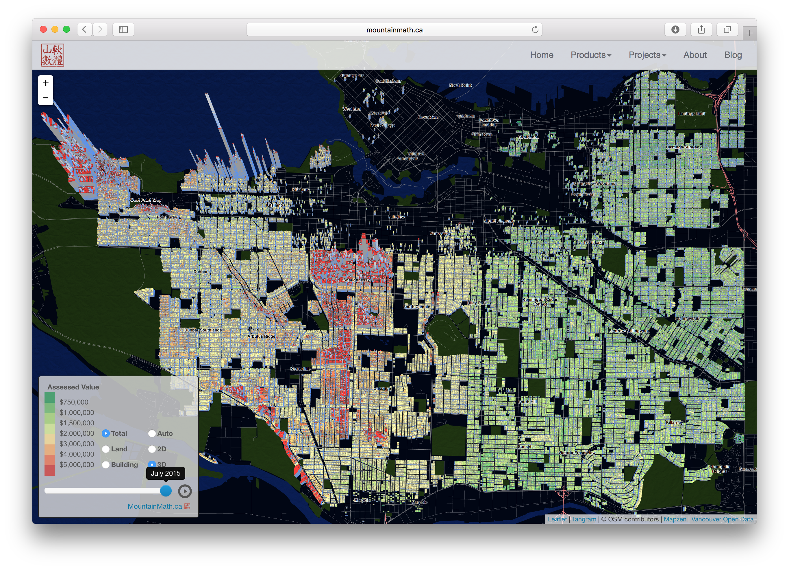
Vancouver Home Values
Mapping Vancouver property values and value changes over time.
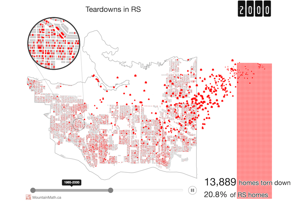
Teardown Index
Data story looking at Vancouver's teardown cycle over time.
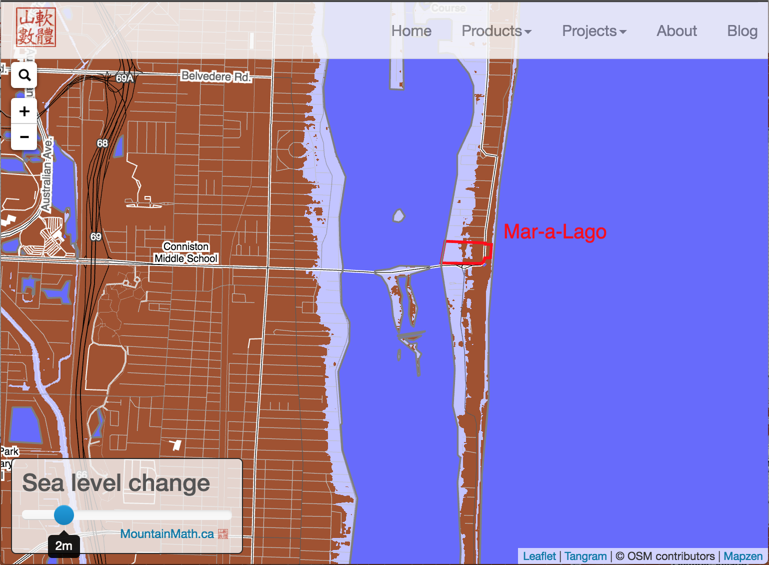
Global Sea Level Rise
Interactive global map exploring sea level rise scenarios.
Global Bikeshare Map
Custom map designed for cycling with a dropdown to select global bike share cities.
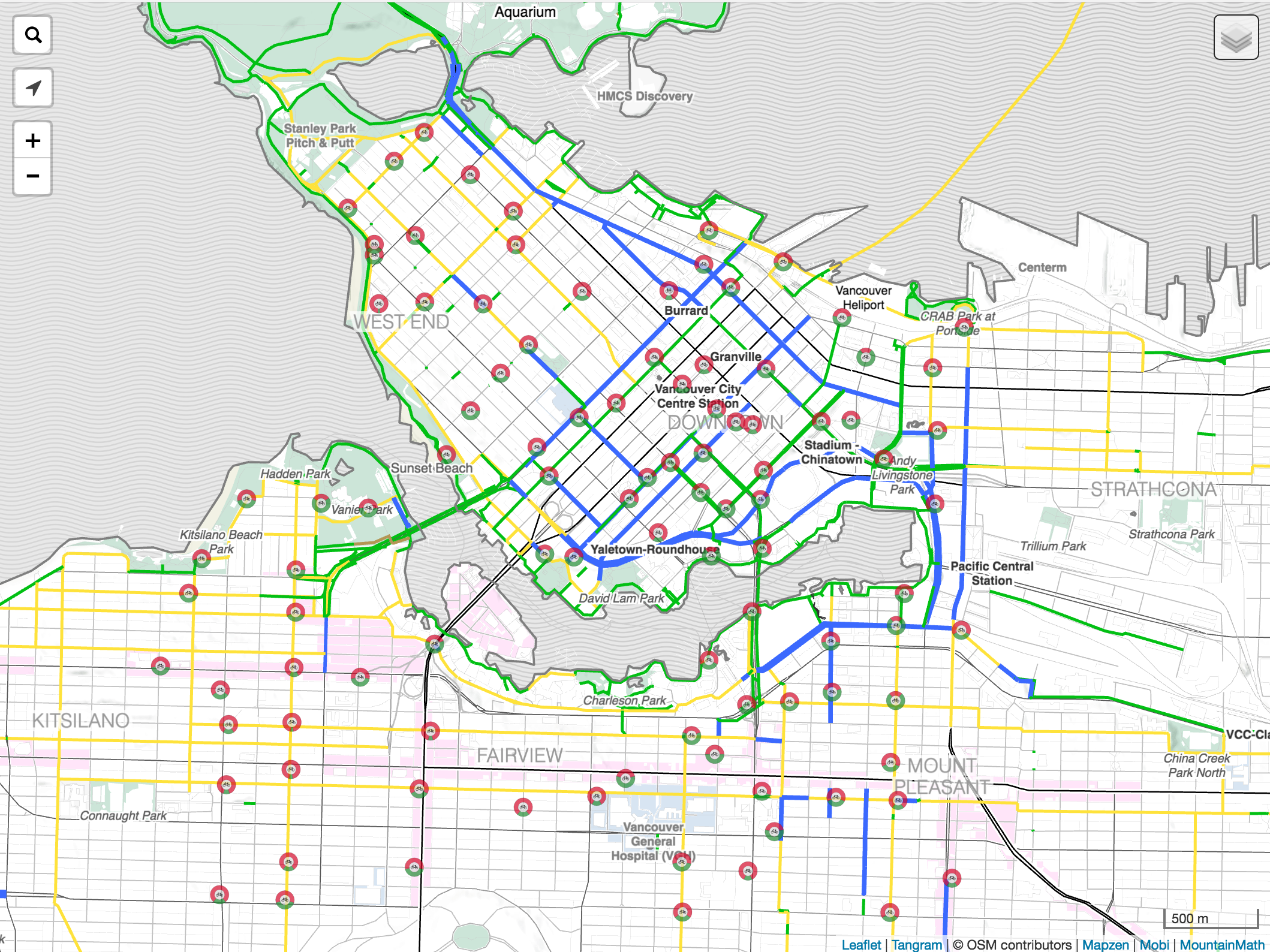
Mobi Bikeshare Map
Custom map designed for cycling with live Mobi bike share stations.
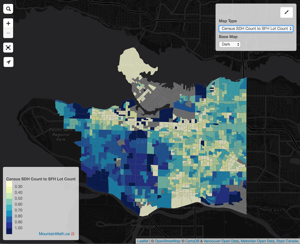
Mixing Census & Property Data
Layering assessment values on top of census demographics.
Vancouver Land vs Buildings
Animating Vancouver's residential land and building values over time.
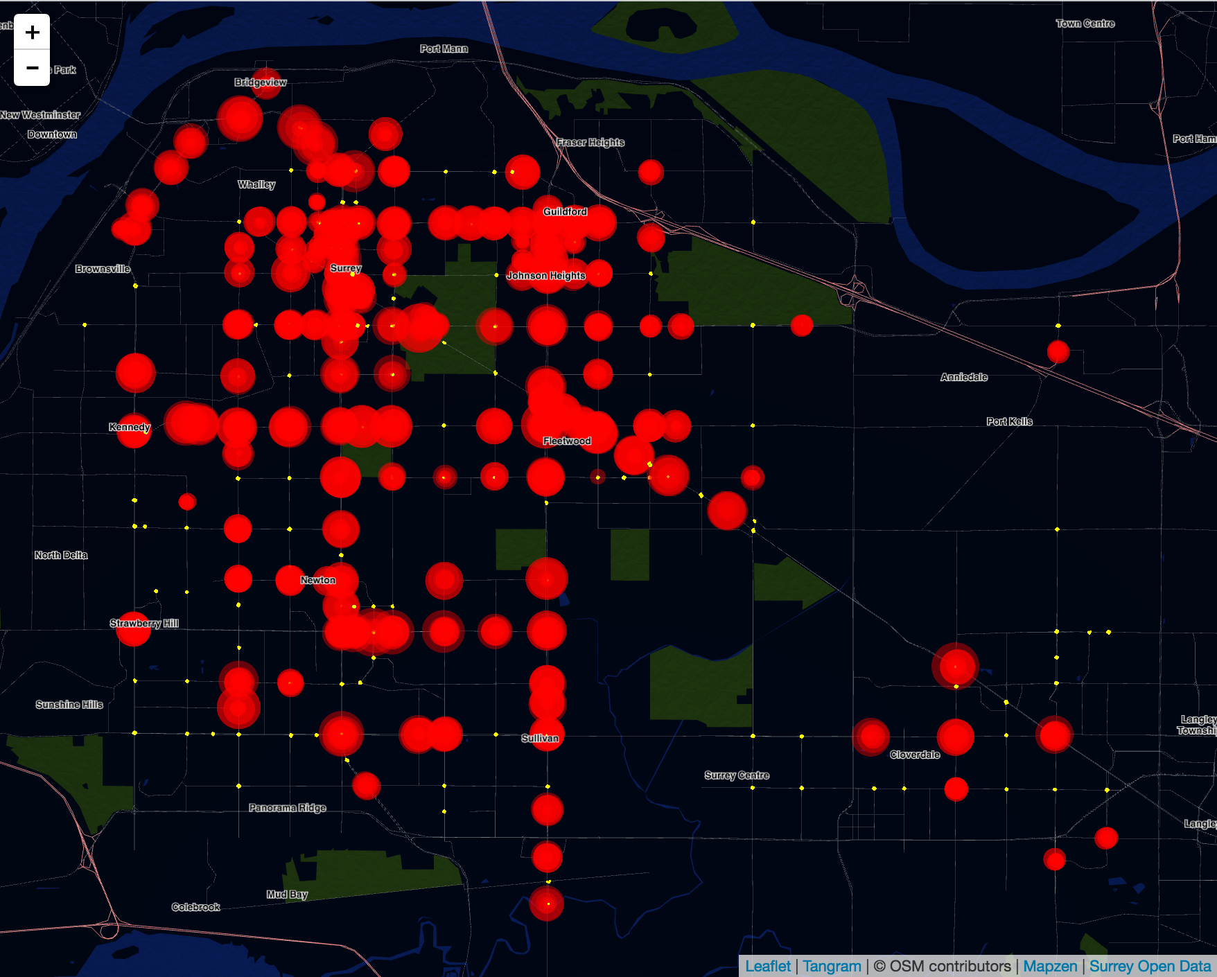
Surrey Traffic Loops
City of Surrey traffic loop counts from the last 24 hours.
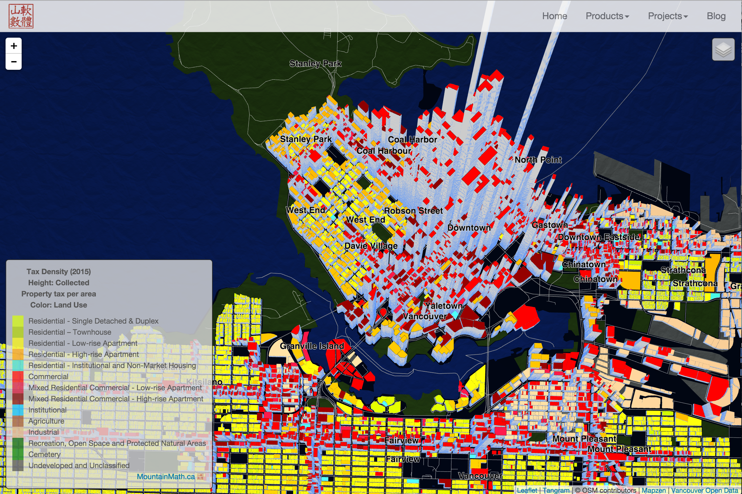
Vancouver Tax Density
Visualizing Vancouver property taxes collected per area by land use or zoning.
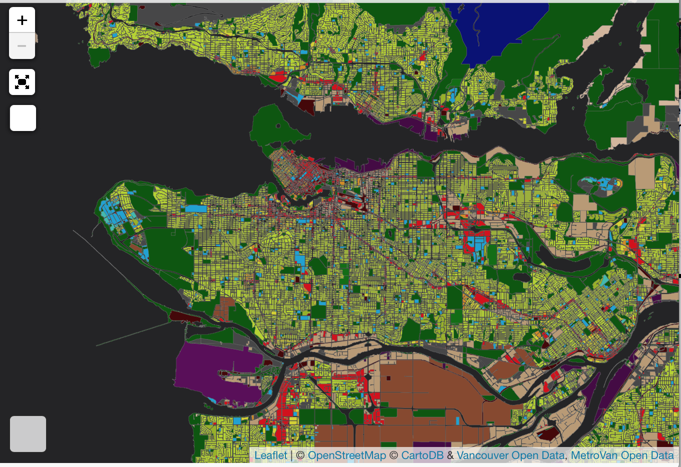
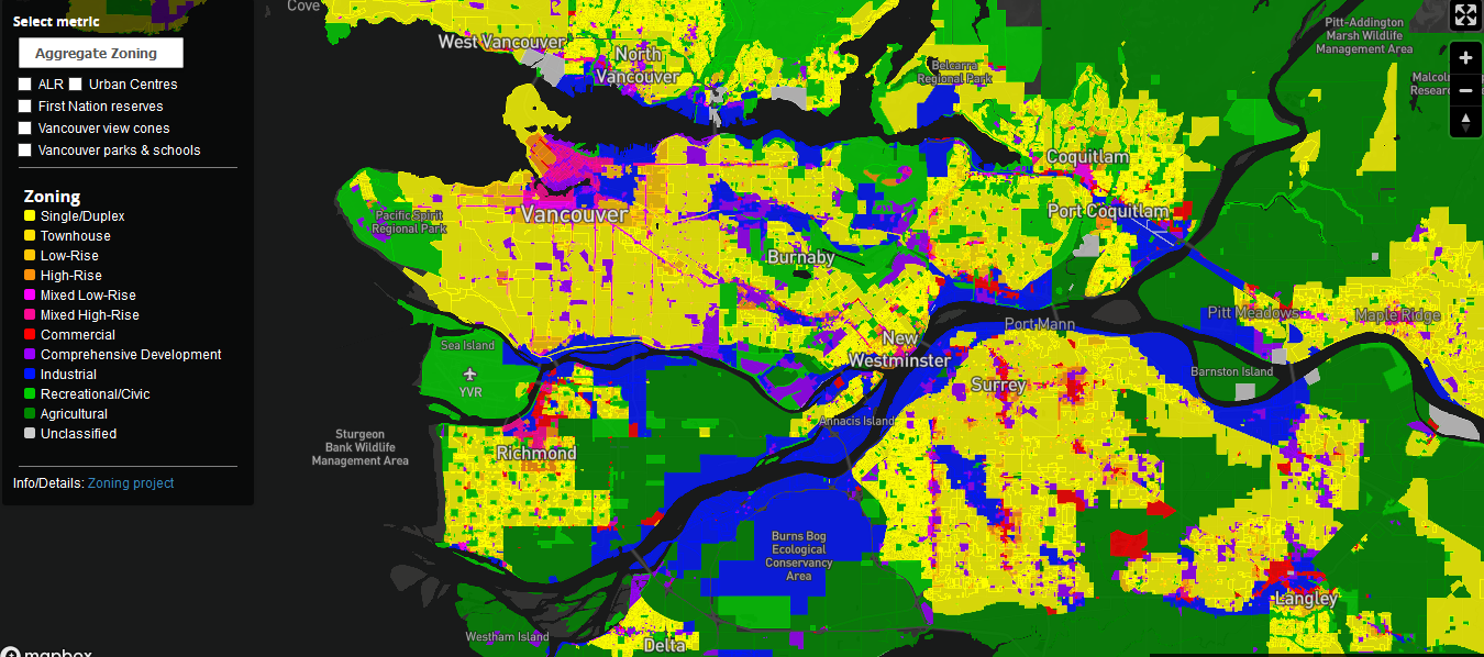
Metro Vancouver Land Use
Interactive high-detail land use map of the Metro Vancouver region.
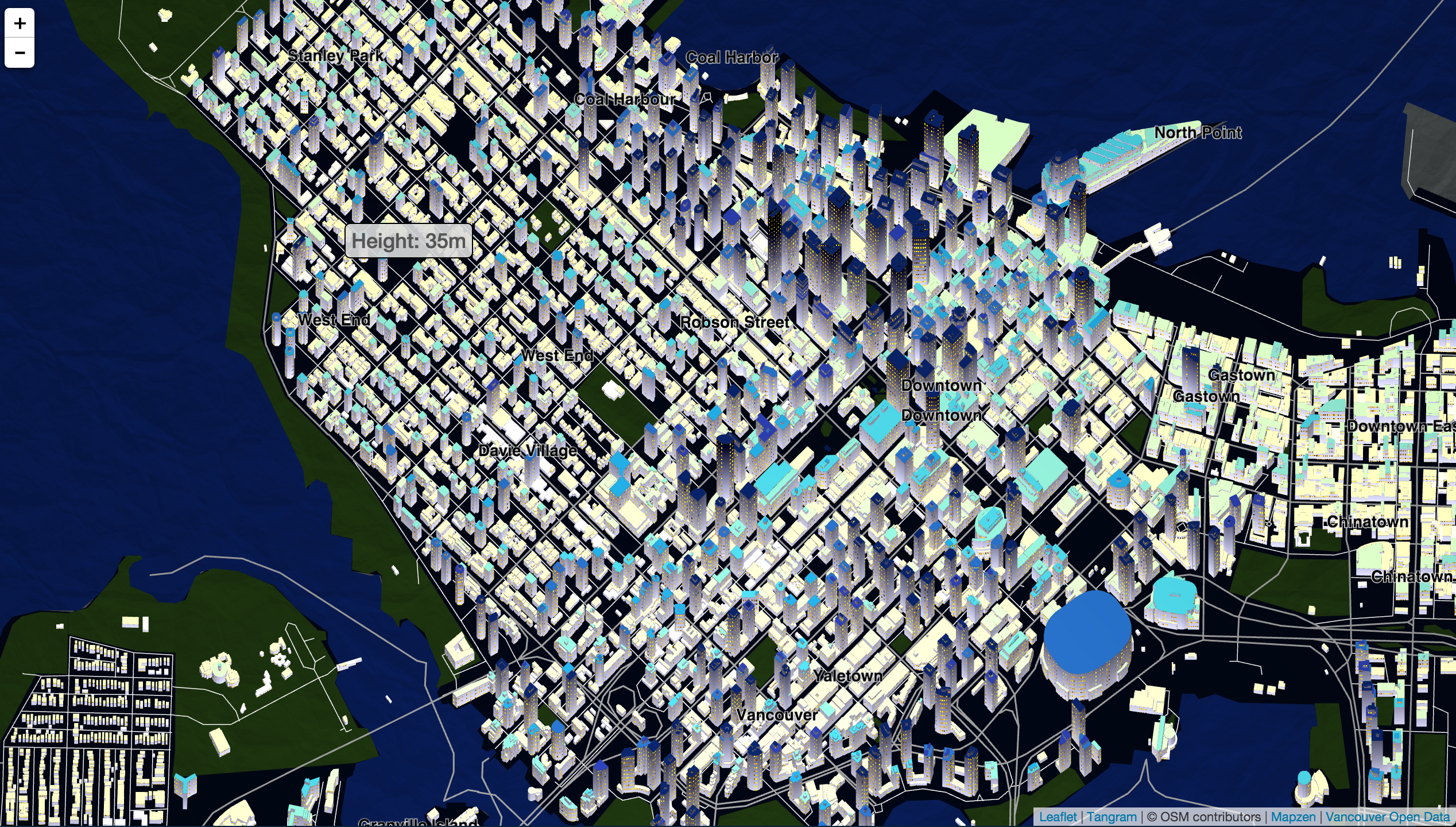
Vancouver Building Heights
Mapping LiDAR-generated Vancouver building data in 3D.
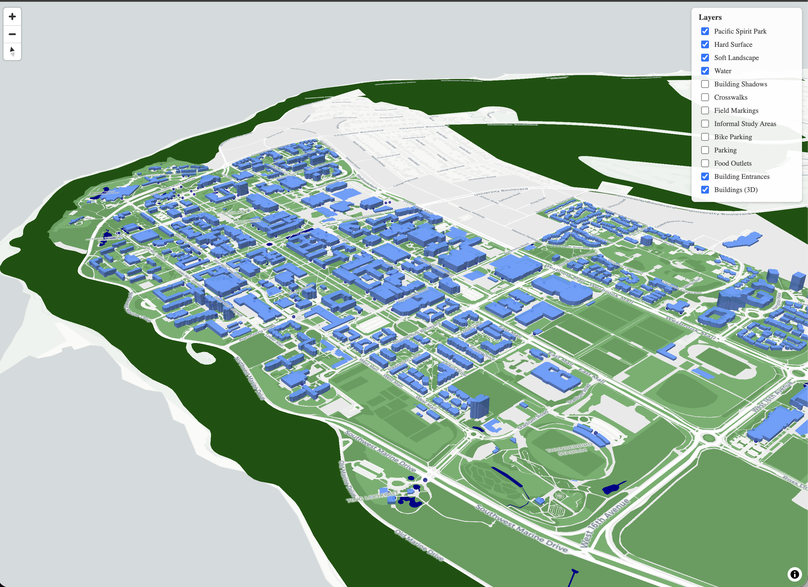
UBC Campus Map
Interactive 3D map of the UBC campus with toggleable layers for buildings, landscape, parking, and more.
Vancouver Census Exploration
Mapping select census variables for the City of Vancouver.
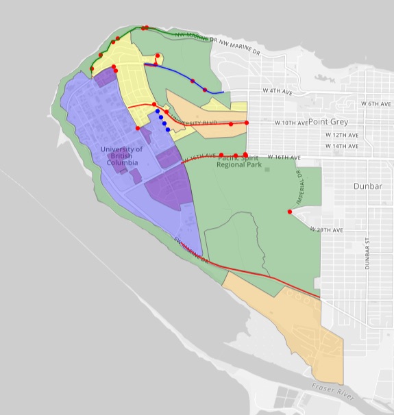
BikeWalkUBC
Community engagement and collaborative mapping tool to address walking and cycling issues around UBC.
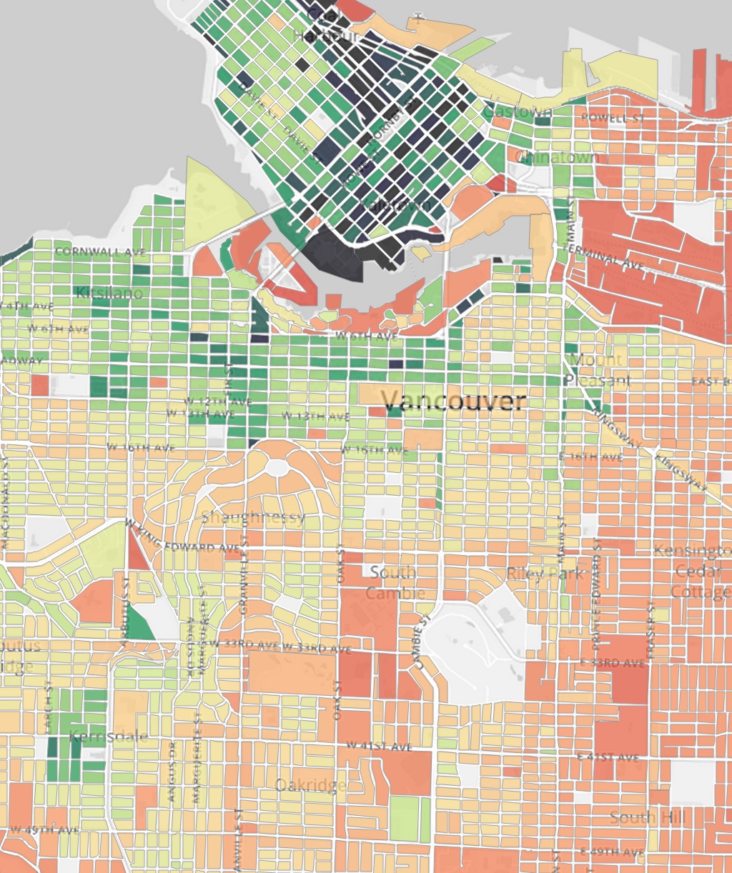
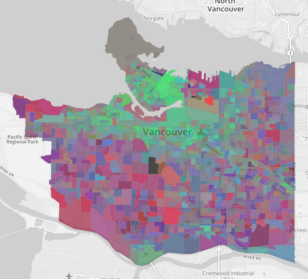
Vancouver Assessment Map
Visualizing Vancouver assessments and related data.